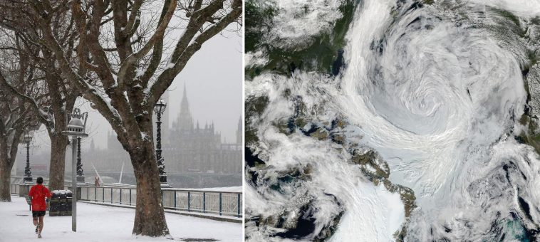
Summer may be approaching but the Met Office has warned wintry weather could spoil families’ plans over the long weekend.
Brits are basking in warm weather today, with highs of 20C forecast and only light winds.
The only exception to the sunny skies will be in western parts – where showers are expected to dominate.
ARCTIC PLUNGE
But conditions are expected to worsen as the week continues and heads into the May bank holiday.
The Met Office says there will be some dry and bright patches as the week progresses.
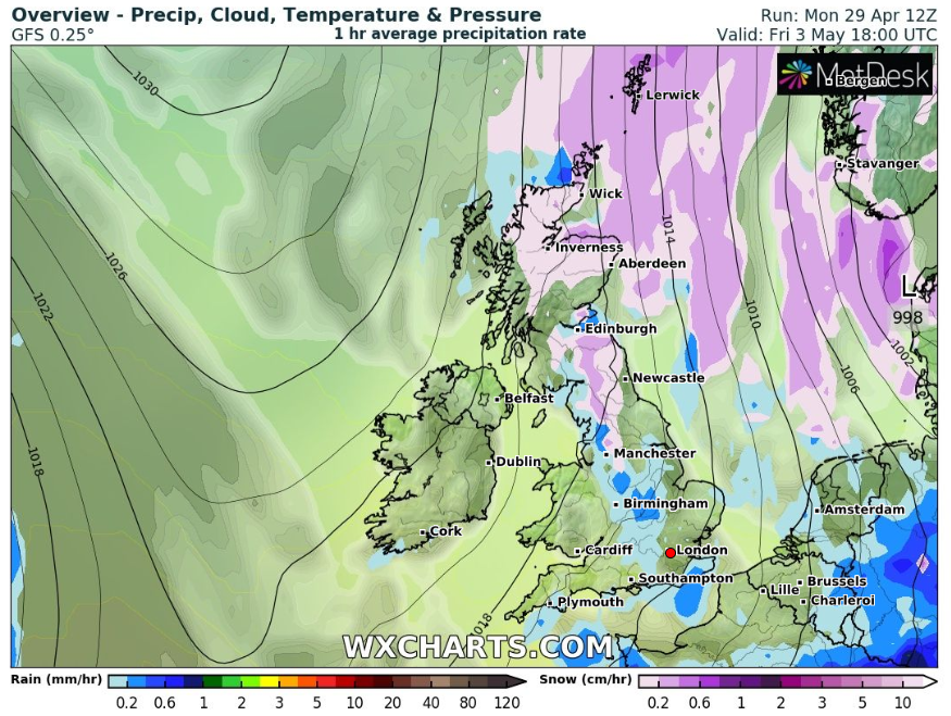
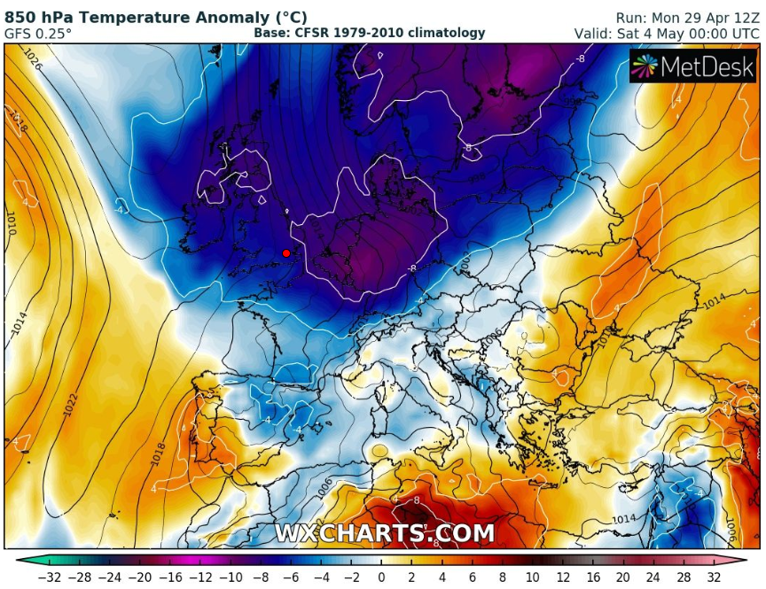
But Friday should see much colder weather as Arctic air plunges southwards.
Met Office forecaster Luke Miall said: “I think there is small chance of seeing some snow in North East Scotland with some hail coming out of eastern areas in England.
“It’s likely it will happen on Friday and Saturday and will affect the eastern part of the country.”
Elsewhere could see widespread frost – and high ground in Scotland could get some sleet.
A dramatic change in the Arctic air will see it push southwards, which will cause the weather to turn wintry.
Saturday and Sunday will see scattered showers but temperatures are expected to pick up a bit.
The Weather Outlook has forecast areas in the north of England may also see some of the white stuff.
Brian Gaze, director and forecaster for The Weather Outlook said: “During Friday a dramatic change takes place. Cold Arctic air sweeps southwards and showers turn wintry even to low levels in the North. A widespread frost sets in overnight.
“On Saturday showery affects central and eastern Britain. In the North it could fall as snow at times, especially over higher ground. Western areas should be dry.
“It will be cold for the time of year.”
WINTRY SHOWERS
The Weather Channel also predicted sleet or snow over the weekend, as the mercury plummets.
A spokesman said: “Bitter Arctic air will plunge across the country spreading a wintry weekend chill in a shivering northerly wind.
“The cold will initially affect the north of the UK as the week progresses with lower pressure over Scandinavia luring the chill from the North Pole.
“Pressure will build across the UK towards the end of the week allowing the bone-chilling cold to move further south, wrapping the whole of the country in the bitter air.”
SHOWERS FOR SOME
In Northern Ireland and western parts of Scotland, thicker cloud will linger and cause outbreaks of rain for much of Tuesday, the Met Office said.
But even here, temperatures should hold up in the low-to-mid teens.
Pollen levels are also expected to be high in most parts apart from the west – where the risk is moderate.
SPANISH PLUME ON THE WAY
But Brits can expect to enjoy higher than average temperatures in the weeks to come – and it’s likely to last at least until the beginning of June.
The Met Office’s long-range weather forecast – which covers a three-month period – sees a 900-mile-wide Spanish plume hitting these shores bringing with it some sizzling temperatures.
And Weather Outlook forecaster Brian Gaze believes highs of 28C could arrive in Britain later in May as warm air blows in from Spain.
He said: “28C would not be a surprise later in May, with warm air expected to arrive from southern Europe, known as a ‘Spanish plume’.”
Although it’s not yet possible to predict exactly how hot it will get in coming months, the long-range weather outlook is currently looking on the warmer side over the coming weeks.